


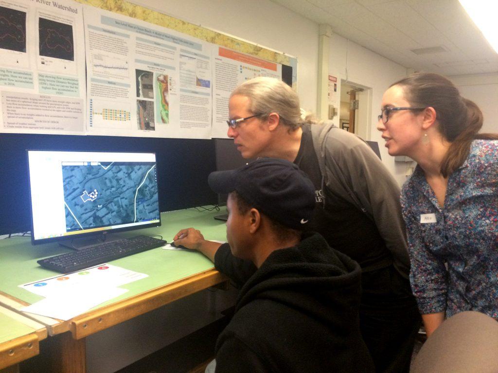
SF State students explored the different applications of crowd-mapping at the Institute for Geographic Information Science’s first mapathon event Wednesday at 6 p.m. in the HSS Building in celebration of Geographic Information Sciences Day and National OpenStreetMap Geo Week.

“It’s a way to use crowdsourcing to get spatial information about places that are potentially vulnerable to natural disasters or humanitarian disasters and provide people with the ability to plan ahead,” said SF State’s Institute for Geographic Information Science Associate Director Aiko Weverka.
The event, which was held in collaboration between British and American Red Cross, the Humanitarian OpenStreetMap Team and Doctors Without Borders, trained attendees to use OpenStreetMap, an open-source software used on mobile apps, websites and hardware devices that allows anyone to contribute to the cartography of any area in the world, according to the software’s website.
“Every time you open Yelp and look for a nearby restaurant or print out directions on Google Maps, you’re relying on those application’s underlying spatial information,” Weverka said. “That’s something that we almost take for granted nowadays, but all of those road networks and restaurant locations were collected by someone at some point.”
Geography major and event attendee Karina Fastovsky said she appreciated the accessibility of OpenStreetMap and crowd mapping.
“Since it’s something that is open to everybody, it’s not used too specifically,” Fastovsky said. “Other people can come in and check (the changes to the map) — if they see it’s wrong, they can fix it.”
OpenStreetMap receives contributions from mapping enthusiasts, Geographic Information Science professionals, engineers running the OpenStreetMap servers and humanitarians mapping disaster-affected areas, according to the software’s website.
“OpenStreetMap is a very powerful tool for capturing information in real time that allows people to map what’s important to them personally, rather than what’s prioritized by a government, an NGO, or a business,” Weverka said.
Jerry Davis, director of SF State’s Institute for Geographic Information Science started SF State’s mapping program in the late 1980s and said he thinks the trend is still growing.
“When I started in this business, (mapping) was used in federal agencies like the Census Bureau,” Davis said. “Over the time I’ve been teaching this, it’s expanded into state agencies – CALFIRE, the water quality control board — all these places where maps are an important part of what they do.”

OpenStreetMap is also an important tool for jobs in the field, according to geography major Nick Paton, who said that he was glad to get some first-hand training in the software.
“One of the reasons I got involved is because I was looking at different jobs, and some of the jobs preferred it if I had experience using OpenStreetMap,” Paton said. “Just to have this and be able to say that I have used it and can use it in my spare time, I could say that and use that on my resume when I apply for a job.”
According to Davis, the crowd-sourcing movement and crowd-mapping events allows departments like the Institute of Geographic Information Science to use volunteerism to add to their knowledge of maps.
“We’re needing constantly to update things,” Davis said. “I say technology has moved — as such, it is easier for more folks to be involved in this, and also people with greater expertise to contribute in an even bigger way.”
With data becoming easier to collect and manage and people’s increasing reliance on maps in their everyday life, Weverka said she believes crowd-mapping is taking off.
“We’re drawn to contributing to something that shapes the way we and others view our communities,” Weverka said. “Maps are a great way to convey complex information — if a picture’s worth a thousand words, a map is worth even more.”
Teddy Weverka • Jan 5, 2016 at 10:16 am
If should read “Weverka said she believes crowd-mapping is taking off.”